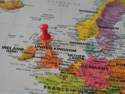
The United Kingdom, commonly known as the UK, is a sovereign state made up of four distinct countries—England, Scotland, Wales, and Northern Ireland. Each has its own geographical boundaries, cultural identity, and administrative structure, yet they are united under one central government. Understanding these Geographical Divisions of the UK is essential for the study of geography, history, and civics, as they play a significant role in governance, education, and regional development.
Table of Contents
- Introduction
- Meaning of Geographical Divisions
- Overview of the United Kingdom
- England – Location, Counties, and Key Features
- Scotland – Location, Regions, and Key Features
- Wales – Location, Counties, and Key Features
- Northern Ireland – Location, Counties, and Key Features
- Importance of Geographical Divisions in Education and Governance
- Conclusion
- Revision Questions
Meaning of Geographical Divisions
Geographical divisions refer to the way a country’s land is separated into specific regions based on political, cultural, or natural boundaries. In the case of the UK, these divisions are political units that also reflect historical developments, geographical landscapes, and administrative needs.
Overview of the United Kingdom
The UK is located off the north-western coast of mainland Europe, surrounded by the Atlantic Ocean, the North Sea, the English Channel, and the Irish Sea. It has a total land area of about 243,000 square kilometres and is home to over 67 million people. The four countries within the UK share a common monarch but maintain varying levels of self-government.
In addition to its geographic and political structure, the United Kingdom boasts a diverse range of landscapes—from the rolling countryside of southern England and the mountainous regions of Scotland and Wales to the lush green fields of Northern Ireland. This geographical variety supports a wide range of economic activities, including agriculture, tourism, finance, and manufacturing. The UK also plays a significant role on the global stage through its cultural influence, historical legacy, and participation in international organisations such as the United Nations, NATO, and the Commonwealth of Nations.
Geographical Divisions of the UK
England – Location, Counties, and Key Features
England is the largest and most populous country within the UK, covering about 130,279 square kilometres. It is bordered by Scotland to the north, Wales to the west, and the English Channel to the south. England is subdivided into 48 ceremonial counties, each with its own administrative centres and unique historical identity. Major cities include London, Birmingham, Manchester, and Liverpool. (For a complete list, see our List of Counties in England blog post.)
5. Scotland – Location, Regions, and Key Features
Scotland lies to the north of England and covers an area of about 77,933 square kilometres. It is known for its rugged mountains, including the Highlands, and over 790 islands. Scotland is divided into 32 council areas, with major cities such as Edinburgh (the capital) and Glasgow. It has its own legal system, education system, and devolved parliament in Holyrood.
6. Wales – Location, Counties, and Key Features
Wales is located to the west of England, bordered by the Irish Sea to the north and west, and the Bristol Channel to the south. It covers about 20,779 square kilometres and is divided into 22 principal areas, which function similarly to counties. Wales is known for its mountainous national parks, historic castles, and bilingual culture, with both English and Welsh spoken widely. Cardiff is its capital city.
7. Northern Ireland – Location, Counties, and Key Features
Northern Ireland occupies the northeastern part of the island of Ireland, sharing a border with the Republic of Ireland to the south and west. It covers an area of about 14,130 square kilometres and is divided into six traditional counties. The capital city is Belfast, and the region is known for its coastal scenery, cultural heritage, and historical landmarks.
Importance of Geographical Divisions in Education and Governance
The geographical divisions of the UK are vital for teaching students about political boundaries, cultural diversity, and governance. They help in understanding how local authorities are structured, how resources are distributed, and how cultural heritage is preserved in different parts of the country.
Geographical Divisions of the UK – United Kingdom
Table of UK Countries
| Country | Capital City | Population (Millions) |
|---|---|---|
| England | London | 56.5 |
| Scotland | Edinburgh | 5.4 |
| Wales | Cardiff | 3.1 |
| Northern Ireland | Belfast | 1.9 |
Revision Questions on United Kingdom
- Name the four countries that make up the United Kingdom.
- Which country is the largest by land area in the UK?
- How many ceremonial counties are there in England?
- Which country shares a land border with the Republic of Ireland?
- What is the capital of Wales?
Conclusion on the Geographical Divisions of the UK
The United Kingdom is a geographically and culturally diverse sovereign state composed of four distinct yet interconnected countries: England, Scotland, Wales, and Northern Ireland. Each of these countries not only holds a unique place in the UK’s historical development but also contributes significantly to its cultural, political, and economic identity.
England, the largest of the four, serves as the administrative and political heart of the UK, with London as both its capital and the capital of the entire United Kingdom. Scotland, with its rugged Highlands and centuries-old traditions, has a devolved government and maintains a strong sense of national identity, despite being part of the union since 1707. Wales, known for its mountainous landscapes and rich Celtic heritage, also enjoys a measure of political autonomy and preserves its native Welsh language and traditions. Northern Ireland, sharing the island of Ireland with the Republic of Ireland, has a complex political history but remains a key part of the United Kingdom, with its own devolved legislature in Belfast.
Geographically, these countries are divided into regions, counties, and local authorities that reflect centuries of historical evolution and administrative reforms. While each country shares certain similarities—such as participation in the UK Parliament and economic integration—they also exhibit marked differences in legal systems, education policies, health care administration, and local governance.
In conclusion, the geographical divisions of the United Kingdom are more than just lines on a map—they represent the diverse identities, cultures, and governmental frameworks that coexist within a unified political system. Understanding these divisions is essential for appreciating the complexity and unity of the UK as a modern nation-state.
Frequently Asked Questions (FAQ) On United Kingdom
1. How many countries make up the United Kingdom?
The United Kingdom is made up of four countries: England, Scotland, Wales, and Northern Ireland.
2. What is the difference between the UK, Great Britain, and England?
The UK (United Kingdom) includes England, Scotland, Wales, and Northern Ireland.
Great Britain includes England, Scotland, and Wales but not Northern Ireland.
England is just one country within both Great Britain and the UK.
3. How many counties are there in England?
England has 48 ceremonial counties, each with its own local administration and historical background.
4. Which UK country has the largest population?
England has the largest population, with over 56 million residents, making it the most densely populated part of the UK.
5. Does each UK country have its own government?
Yes, Scotland, Wales, and Northern Ireland have devolved governments with powers over certain areas like education and health. England is governed directly by the UK Parliament in Westminster.
6. What is the capital of the United Kingdom?
The capital of the UK is London, which is located in England.
7. How are counties in the UK used today?
Counties in the UK serve administrative, ceremonial, and cultural purposes, helping in governance, local identity, and organisation of services.
RELATED ARTICLES